
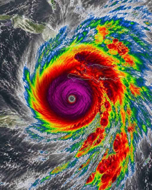
Hurricane Melissa has rapidly intensified into a powerful Category 5 hurricane, with sustained winds exceeding 157 mph. The storm has developed a well-defined eye and a massive circulation while moving over exceptionally warm Atlantic waters. Its rapid strengthening has attracted the attention of meteorologists, who are closely monitoring its structure, strength, and movement. Although Melissa’s exact future path remains uncertain, officials are urging people in potentially affected coastal areas to stay informed and begin preparing for possible dangerous conditions.
Category 5 hurricanes are the highest classification on the Saffir-Simpson Hurricane Wind Scale and can cause catastrophic damage. Extreme winds may destroy roofs, uproot trees, damage power lines, and severely affect buildings. However, the greatest dangers may also come from storm surge, heavy rainfall, flooding, and dangerous surf. Storm surge can push seawater far inland, while intense rainfall can overwhelm drainage systems and cause flash flooding. These hazards can affect communities far from the hurricane’s center.
Meteorologists are using satellites, reconnaissance aircraft, and advanced computer models to track Melissa and predict its future path. Despite modern forecasting technology, hurricane tracks can change significantly because of shifts in atmospheric conditions. Experts therefore warn residents not to focus only on the forecast center line. Tropical-storm-force winds, heavy rain, coastal flooding, and dangerous surf can extend hundreds of miles from the eye.
Emergency officials are encouraging families in vulnerable areas to prepare before conditions worsen. Residents should gather water, non-perishable food, medications, flashlights, batteries, important documents, and pet supplies. Families should also review evacuation routes and secure outdoor furniture and other loose objects. Waiting until the last minute can make evacuation dangerous because roads may become flooded and travel conditions may deteriorate quickly.
As Melissa continues across the Atlantic, forecasters will monitor changes in its strength and direction. The hurricane could weaken, maintain its intensity, or change course as environmental conditions evolve. Residents should rely on official weather agencies for accurate updates and follow evacuation orders when issued. Melissa’s rapid intensification is a reminder that hurricanes can strengthen quickly and that early preparation is essential for protecting lives and property.